
South Korea: USO DMZ Tour Review
I arrived at the USO for the start of the tour by taking the train to Samgakji station, taking exit #10, and walking toward Seoul Station until I reached the United Service Organizations (USO) office at Camp Kim’s Gate #17. From there I signed in with my passport and boarded the bus. Our tour guide’s name was Lena and she did a good job of explaining what we were seeing as we took the bus North out of Seoul towards the DMZ. She explained that Seoul is separated by the Han River and connected by 31 bridges which is a key to efficient transport in the city.
DMZ History
Before explaining my trip to the DMZ, I want to explain what I learned about the history leading up to the creation of the DMZ as it really adds to the significance of the tour stops and why the DMZ is so interesting.
The 38th parallel, which roughly divides the Korean Peninsula in half, marked the boundary between the US and Soviet administration areas at the end of WWII. After the creation of the Democratic People’s Republic of Korea (DPRK or North Korea) and the Republic of Korea (ROK or South Korea) in 1948, this parallel became a defacto border and a tense front of the cold war. Due to the Soviet and US influence over the regions, North Korea adopted a communist government while South Korea adopted a right wing government.
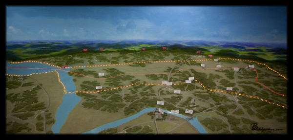
Display in Third Tunnel Museum Showing DMZ Area
In 1950, North Korea invaded South Korea across the 38th parallel marking the outbreak of the Korean War. North Korea quickly pushed through South Korea until a rapid UN counter-offensive drove the North Koreans past the 38th parallel and almost to the YaluRiver, when China entered the war on the side of North Korea. The Chinese intervention along with Soviet support forced the allied forces to retreat back South behind the 38th parallel. It amazed me to see how much territory changed hands during the war and it is sad yet fitting that after all of the fighting the border stabilized back to essentially where it began, diagonally across the 38th parallel. The conflict claimed over three million lives and finally ended with the creation of the DMZ.
The DMZ is a defacto border that runs approximately along the 38th parallel in a diagonal manner separating North Korea from South Korea. The border was created by the Korean Armistice Agreement between the UN, North Korea, and China (note that South Korea was not part of the agreement) in 1953. The demilitarized zone is 250 kilometers long, approximately 4 kilometers wide, and, despite the name, surrounds the most militarized border in the world. Even on the drive from Seoul I could begin to see the barbed wire, guard posts, and road blocks that remain prepared for potential conflict with North Korea.
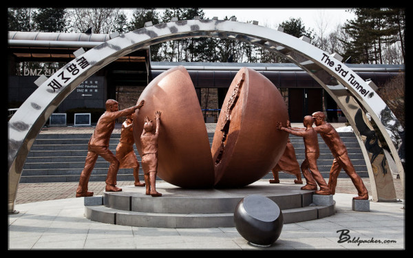
Third Tunnel
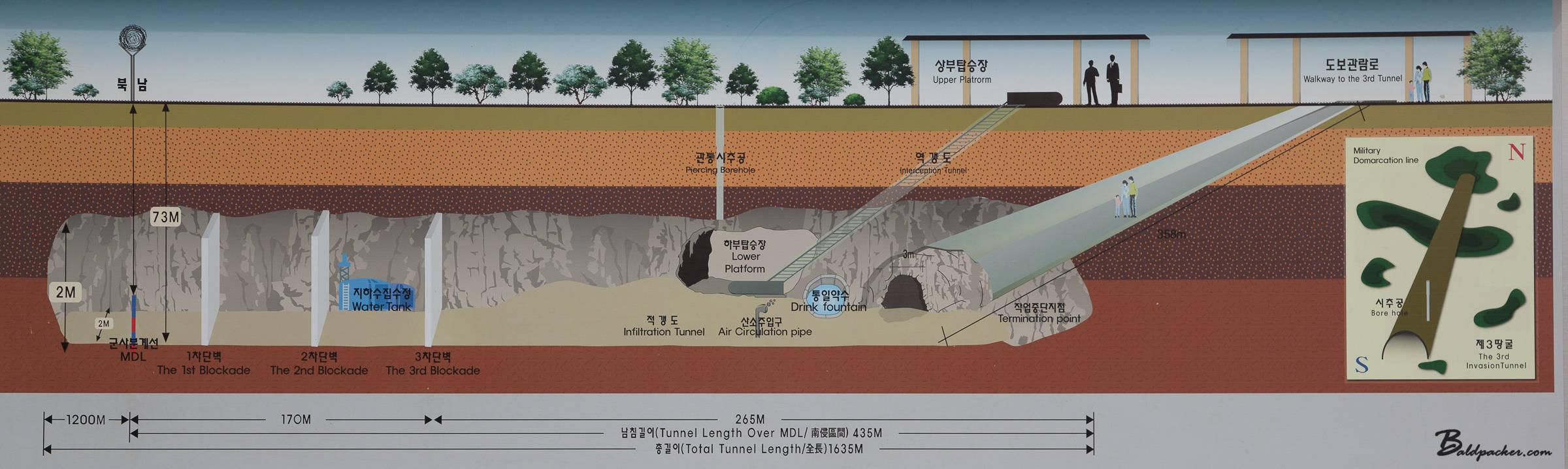
Our first tour stop was the third tunnel, or “third tunnel of aggression” as its sometimes known. The third tunnel was discovered in 1978 and is one of four tunnels discovered in South Korea (it is expected there could be up to twenty more) that were dug by North Korea, assumably for the purpose of attack. The third tunnel is the most famous as it was only 44km from Seoul when it was discovered and could have accommodated 30,000 men per hour with light weaponry, making it a significant threat to South Korea and the 1953 Armistice Agreement.
The third tunnel is now a tourist attraction and there is a museum with an excellent movie explaining the conflict and the tunnel. There were also many interesting displays describing the history of the DMZ and showcasing many of the weapons used in the Korean War. Apparently, North Korea had first denied building the tunnel and suggested that South Korea was behind its construction. However, the dynamite drill marks and incline of the tunnel (so water flows towards the entrance rather than end being dug) provided rather conclusive evidence that North Korea was behind the construction. That’s when North Korea claimed that the tunnel was actually a coal mine. Hysterically, the granite walls of the tunnel were painted with black “coal” to try and support this statement, even though geologically it is not possible.
It is also possible to enter the tunnel itself, though no photos are allowed. South Korea drilled a tunnel 358 meters long and 70 meters deep to intersect with the end of North Korea’s tunnel and put up three large concrete barriers to prevent North Korea from re-entering it. The walk down to the tunnel is quite long and steep and even though the space is quite large, could certainly lead to claustrophobia among some people. Once in the tunnel itself, I had to duck quite often and was very thankful to have been wearing one of the supplied hard hats. Water naturally drops from seams in the granite and at the end of the pedestrian tunnel, I could see through a small window in the first barrier towards the second large concrete barrier. It is hard to imagine 30,000 troops being able to fit through the tunnel in an hour, but I expect it would be possible with well selected and trained personnel. Apart from the JSA itself, the third tunnel was my favourite stop of the tour.
Dora Observatory
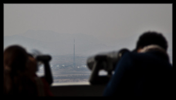
The next stop was the Dora Observatory. The observatory is on top of MountDora (Dorasan) and looks across the DMZ. Once again, they showed a short movie in a large theater with floor to ceiling glass walls that look out over North Korea. The movie gave a brief description of the observatory and then went on to explain the sites visible from the observatory. After the film we were let outside where there were a row of pay-per-use binoculars to allow for closer viewing of North Korea and the DMZ. Unfortunately, photography is not allowed, but I was able to observe many of the landmarks and sites identified in the video.
Viewing North Korean Flag Pole from South Korea
The main sites are Kijong-dong, also known as “propaganda village”, which is a town of multi-story apartments with electric lighting that would appear quite luxurious to rural Koreans in the 1950s when they were constructed. Funnily enough, modern telescopes prove the buildings are just empty concrete shells that lack window glass and interior rooms. The reason Kijong-dong is known as propaganda village is because up until 2004, massive speakers directed propaganda broadcasts towards South Korea.
The next funny site was the South Korean and North Korean flag towers. In the 1980s, South Korea built a 98.4 meter tower with a 130kg South Korean flag in its village of Daeseong-dong. The North Korean government responded by building a 160 meter tower with a 270 kg North Korean flag in Daeseong-dong.
Also visible on the mountain tops were radio jamming towers operated by North Korea, which are clearly intended to block any radio or television broadcasts from entering North Korea. The final noteworthy site was the large industrial area known as the Kaesong Industrial Park. The park is 10km north of the DMZ, an hour’s drive from Seoul, with direct road and rail access to South Korea. The park is hoped to help lead North Korea and South Korea towards unification as the governments mutually benefit from the industrial park’s operation. South Korean companies obtain cheap North Korean labour (I heard labour only costs 1/3 of what it would in China) while North Koreans gain ~53,000 jobs and ~$90 million per year in wages, paid directly to the North Korean government. It is hoped the successful cooperation in the industrial park may one day lead to more cooperation in the countries, allowing for families divided by the Korean War to reunite and South Korea to directly access Asian and European markets by rail via North Korea.
Yes! Finally someone writes about dmz trip.
Incredible look into the DMZ!